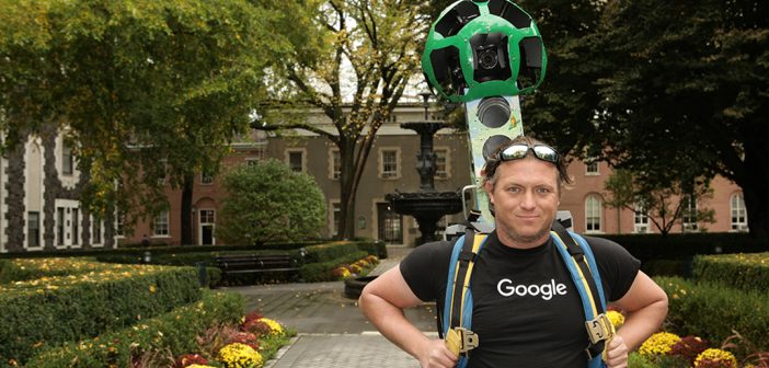
Last month, Google Street View dropped by to capture street level imagery of the Rose Hill, Lincoln Center, and Westchester campuses. In order to collect the imagery, Google used its Street View Car and the Trekker, a wearable backpack with a camera system on top. The Trekker is worn by an operator and is walked through pedestrian walkways on foot, automatically gathering images as it goes. That imagery is then stitched together to create the 360-degree panoramas you see today in Google Maps.
The alleyway between University Church and Queen’s Court, the patch of green behind the Lowenstein Center, and the small creek running through Westchester’s campus all got their due. Both the car and the backpack use a 15-lens camera to capture the panoramic images of the campuses and its surroundings.
The images will appear on Google Maps by summertime next year.


